Characteristics:
- Fourteenth largest watershed in West Vancouver
- Discharges into Eagle Creek, 140 metres upstream of mouth
- Two branches; west branch originates in Cypress Park Estates, east branch originates on Caulfield Plateau
- Bordered by Eagle Creek watershed to the west and Willow Creek and Cypress Creek watersheds to the east
- Watershed almost entirely within urban development
- Fifty-eight percent of watershed lies between Upper Levels Highway and Marine Drive
History:
- Name first appears in Dayton and Knight report on West Vancouver drainage
- Extensive loss of wetlands and obliteration of a section of the creek channel during development of Caulfield Plateau and Cypress Park Estates in mid 1970’s
Watershed use:
- Residential: approximately 535 houses in the watershed
- Commercial: 1 mall and 2 schools and Recreation Centre
- Recreational:
- Sahalee Trail goes from Westport Road near Eagle Harbour School to Caulfield Plateau, other trails
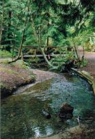
- Two parks: Parc Verdun and Woodburn Park
- Fish: cutthroat trout to Westport Road, coho to Keith Road
- Wildlife: diverse population of mammal, bird and amphibian inhabit the watershed (ie. otter, raccoon, skunk, mink, great blue heron, kingfisher, American Dipper, ensatina, Western Red Backed Salamander)
- Keith Road, Marine Drive, Westport Road, BC Rail
Concerns:
- Wood Creek classified as lost by Fisheries and Oceans Canada due to the large amount of culverting and storm drains in the watershed
- Water quality:
- extensive network of storm drains discharge into Wood Creek periodically resulting in the introduction of pollution
- one sewage pumping station at Woodburn Park discharges raw sewage to the creek when broken
- Water flow:
- large number of storm drains increases peak flow
- double culverts under Keith Road splits creek and results in less water available for migrating salmon
- Fish barrier: repeated accumulation of debris in the trash racks at Parc Verdun
- Channelization in the lower reaches
- 130 metres of culvert under Keith Road, culverts under Marine Drive, Eagle Harbour Primary School driveway, lower Westport Road, highway, and upper Westport Road
Key Interest Groups:
- Federal: Department of Fisheries and Oceans
- Provincial: Ministry of Environment, Lands and Parks; Ministry of Transportation and Highways
- District of West Vancouver, District Parks Department
- West Vancouver Streamkeepers
- Community associations
- Eagle Harbour Yacht Club
- School District 45: Rockridge School, Eagle Harbour Primary School
- Caulfield Mall
- BC Rail
- BC Hydro
Watershed Projects:
- Digitized map of urban watershed including storm drain network, SHIM website, 2001
- Water quality testing, North Shore Streamkeepers, 1999
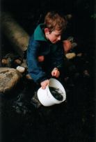
- Spawner surveys, West Vancouver Streamkeepers, 1997 onwards
- Stream survey, West Vancouver Streamkeepers, 1997
- Stocked with coho and chum fry and pre-smolts, West Vancouver Streamkeepers, 1997 onwards
Available Sources of Information:
Maps: TRIM/UTM 92G034
Web Sites:
- http://www.pskf.ca The Pacific Streamkeepers Federation
- www.bcfisheries.gov.bc.ca/fishinv/fiss.html Fisheries Information Summary System (FISS)
- www.bcfisheries.gov.bc.ca/fishinv/index.html includes FISS, Survey Data, Base Maps, Methods
- http://www-heb.pac.dfo-mpo.gc.ca/English/maps.htm includes Fish Wizard, Fisheries Project Registry, SHIM Data with Orthophotos, Wild Threatened, Endangered and Lost Streams of the Lower Fraser Valley
- www.shim.bc.ca Sensitive Habitat Information and Mapping
Reports:
- District of West Vancouver Drainage Survey, Dayton and Knight Ltd., 1973
- Task Force Inquiry into Drainage Policies and Problems. Summary Report. District of West Vancouver, 1977
- Lower Fraser Valley Stream Review, Vol. 1. Fisheries and Oceans Canada. Fraser River Action Plan, 1999
- Wild, Threatened, Endangered and Lost Streams of the Lower Fraser Valley, Summary Report. Fisheries and Oceans Canada. Fraser River Action Plan, 1997
- North Shore Streams- Nutrient Impacts. North Shore Streamkeepers, 1999