Wood Creek Watershed
Summary
Characteristics:
- Fourteenth largest watershed in West Vancouver
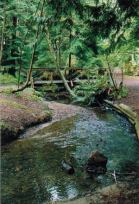
- Originates in two branches, the west branch originates in Cypress Park Estates; the east branch originates on Caulfield Plateau. Branches merge near the Sahalee Trail at the railway trestle. Creek flows under Westport Road and past Eagle Harbour School, under Marine Drive and through Parc Verdun. Creek flows through 130 m of culvert before emerging to join Eagle Creek 140 m upstream of its mouth
- Watershed almost entirely within urban development. Extensive loss of wetlands and obliteration of a section of the creek channel occurred during development of Caulfield Plateau and Cypress Park Estates in mid 1970’s
Watershed use:
- Residential: approximately 535 houses in the watershed
- Commercial: 1 mall and 2 schools and Recreation Centre
- Recreational: Sahalee Trail, other trails, Parc Verdun and Woodburn Park
- Fish: cutthroat trout to Westport Road, coho to Keith Road
Concerns:
- Wood Creek classified as lost by Fisheries and Oceans Canada due to the large amount of culverting and storm drains in the watershed
- Water quality: extensive network of storm drains discharge into Wood Creek periodically resulting in the introduction of pollution, potential for sewage leak from lift station and sewage lines crossing creek
- Water flow: large number of storm drains in watershed increases peak flow, double culverts under Keith Road splits creek and results in less water available for migrating salmon
- Fish barriers: repeated accumulation of debris in the trash racks at Parc Verdun, 130 metres of culvert under Keith Road and other culverts, channelization in the lower reaches
Watershed Projects:
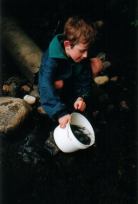
- Annual spawner surveys, 1997 onwards
- Stream survey, West Vancouver Streamkeepers, 1997
- Stocked with coho and chum fry
Prepared by Catherine Sherlock