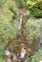
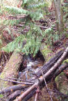
Westmount Creek Watershed
Summary
Characteristics:
- Fifteenth largest watershed in West Vancouver
- Bordered by Cave Creek and Cypress Creek watersheds to the west and north, and Pipe Creek and Rodgers Creek watershed to the east in West Vancouver, BC
- Originates on the south flank of Hollyburn Ridge
- Discharges into Burrard Inlet at West Bay near Radcliffe Avenue
- Fourty-six percent of the watershed is above the limit of development at 366 m (1200 ft), 25% is between 366 m elevation and Upper Levels highway, and 29% is between the highway and Marine Drive
History:
- Land around mouth was pre-empted as District Lot 557 in 1886 by P. A. Allen, a blacksmith at Moodys Ambleside logging camp
Watershed Use:
- Residential
- Park: Benbow Park, Deer Ridge Park
- Recreational: Skyline Trail/TransCanada Trail, other hiking trails, mountain biking
- Fish:
- Wildlife: diverse populations of mammal, bird and amphibian inhabit the watershed
- Train and automobile transportation, power lines
Concerns:
- Morphology:
- Culvert at railway crossing, five road and driveway culverts and several footbridges to highway, culverts at highway and Cypress Bowl Road
- channelization of creek and loss of tributaries through urban area
- Water Quality:
- altered through proximity to urban development and storm drain discharge
- potential for sewer lines breakages
- Current development and future development in upper watershed and associated problems, including:
- increase in imperviousness
- loss of wetlands and tributaries
- construction of storm drain network resulting in altered water quality and quantity
- encroachment into riparian zones
- tributary channelization, bank alteration
- increased erosion into creek
Key Interest Groups:
- Municipal: District of West Vancouver, District Parks Department
- Federal: Department of Fisheries and Oceans
- Provincial: Ministry of Transportation and Highways; Ministry of Water, Land and Air Protection
- West Vancouver Streamkeepers
- BC Rail, BC Hydro
- Ratepayers Association
- Mountain biking clubs
Watershed Projects:
- 500 coho released from the Nelson Creek Hatchery, 2000
- Headwaters studied as part of environmental feasibility study for proposed Hollyburn Golf Course, 1989
- Bank stabilization completed, year unknown (FISS)
- Biophysical surveys, year unknown (FISS)
Recommendations for Further Actions:
- Assess creek for barriers and obstructions
- Install creek name signs at parks and along Marine Drive
Available Sources of Information:
Web Sites:
Reports:
- Lower Fraser Valley Stream Review, Vol. 1. Fisheries and Oceans Canada. Fraser River Action Plan, 1999
- Wild Threatened, Endangered and lost Streams of the Lower Fraser Valley, Summary Report. Fisheries and Oceans Canada. Fraser River Action Plan, 1997
- Creeks in West Vancouver. Hugh Johnston?, 1990
- West Vancouver Drainage. Dayton and Knight, 1973
- Task Force Inquiry into Drainage Policies and Problems, Summary Report. District of West Vancouver, 1977
- Official Community Plan Bylaw No. 3413, 2002
- Hollyburn Ridge Golf Course Technical/Environmental Feasibility Study. Talisman Land Resource Consultants in association with Klohn Leonoff Ltd., 1989
Prepared by Elizabeth Hardy, March 2003