Ioco Creek Watershed
Profile
Characteristics
- Also known as Imperial Creek and Village Creek.
- The 12th largest watershed in Port Moody (out of 16) (Robertson 2000).
- Discharges into Port Moody Arm of Burrard Inlet.
- Bordered to the north and west by the Sasamat Lake watershed, to the east by the North Schoolhouse Creek watershed, and to the south by Burrard Inlet. The northeast section of this watershed falls within the Village of Anmore boundaries.
- Average annual watershed precipitation is 1925 mm (GVRD 1999).
- Average annual watershed flow is 1633 mm, with an additional 650 mm from stormwater runoff.
- In 1996 4.8% of the watershed was developed and impervious to water and 90% of riparian forest was intact. The 1996 GVS&DD watershed classification was 'Excellent' (GVS&DD 1999)
- In general, the area encompassed by this watershed lies on gentle (less than 35%), south-southwest facing slopes with deep, nutrient-rich soils
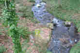
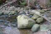
- Ioco Creek is 1.5 km long. The stream originates as sidehill runoff within the boundaries of the Village of Anmore, about 1 km east of Sasamat Lake. Ioco Creek passes under Bedwell Bay Road and flows south through the Ioco Townsite (between Second and Third Avenue) to the Port Moody Arm of Burrard Inlet.
History
- The lower part of the watershed was cleared in 1920 for construction of the Ioco oil refinery and the Ioco townsite. Logging of the remainder of the watershed occurred soon after (City of Port Moody website).
- Industrial activities have polluted the marine environment of Port Moody Arm into which Ioco Creek flows, leading Environment Canada to identify this area as an "environmental hotspot" in 1992 (Dunster and AXYS 1999). These pollutants include the metals cadmium, chromium, copper, lead, and zinc (originating from metal coating, plastic stabilizers, paint pigments, and, to a lesser extent, pesticides and sewage), as well as organic compounds like oil and grease hydrocarbons and polycylic aromatic hydrocarbons (originating from petroleum facilities). Polychlorinated biphenyls (PCBs, used to produce plastics, inks, paints and pesticides but banned since the mid-1970s) persist in low concentrations throughout Port Moody Arm. In 1987, all of these pollutants occured in the highest concentrations near the Ioco refinery, decreasing in concentration towards Indian Arm and the Port Moody tidal flats (Environment Canada 1989).
Watershed Use
- Residential: a small number of single family houses remain in Ioco Village.
- Industrial: the Imperial Oil Company (Ioco) refinery property occupies most of the western half of this watershed.
- Institutional: Ioco School is at the corner of Ioco Road and First Avenue.
- Parks and recreation: Ioco Park and the Ioco Lawnbowling and Tennis Club grounds are both near the Ioco Road / First Avenue intersection in the lower section of the watershed.
- CP Rail has a right-of-way near the stream mouth.
- BC Gas has a right-of-way that parallels Bedwell Bay Road.
- BC Hydro has a powerline right of way which crosses the top of the watershed.
- Fish: Trapping was carried out in the portion of Ioco Creek within the Ioco Townsite in 2002 (Golder 2002). The study found no fish in this section of stream. Coastal Cutthroat Trout (Onchorhynchus clarki clarki) and prickly sculpin (Cottus asper) have been observed in the upper section of this watershed near Bedwell Bay Road (M. Townsend personal observation). Coho (Onchorhynchus kisutch) and Chum (Onchorhynchus keta) as well as three-spined stickleback (Gasterosteus aculeatus) may inhabit the stream mouth below the CP Rail right of way, but sampling has not been carried out on this section.
- Wildlife: coyote, black bear, cougar, bobcat, mule deer, Douglas squirrel, red-back vole, and deer mouse are among the more prominent terrestrial animals (Dunster and AXYS 1999).
- Birds: several species of woodpeckers and raptors use the forest around Lower Hutchinson Creek Ravine, as well as American dipper. Near the mouth of Ioco Creek, shorebirds, waterfowl, bald eagles and blue herons have been observed (Dunster and AXYS 1999, Robertson 2000). Historically, 131 bird species are known to inhabit the Port Moody area (Burke Mountain Naturalists 1994).
- Vegetation: About half of the watershed is undeveloped, consisting of a secondary growth forest ranging in age from 60-80 years. Trees are a mix of western hemlock (Tsuga heterophylla), Douglas fir (Pseudotsuga menziesii), western red cedar (Thuja plicata), red alder (Alnus rubra), broad-leaf maple (Acer macrophyllum) and vine maple (Acer corcinatum). The understory is predominantly salmonberry (Rubus spectabilis), sword fern (Polystichum munitum) and huckleberry (Vaccinium spp.). Several plant communities are present which are of special concern (see below) (Dunster and AXYS 1999).
Concerns
- Culverting: Three culverts are present: one upstream at Bedwell Bay Road and two near the stream mouth at Ioco Road and the CP Rail right of way. The culvert at Bedwell Bay Road is fish passable, but the status lower two culverts could not be determined due to their inaccessability by foot.
- Stormwater: Ioco Creek and its watershed are in good shape compared to many other streams in Port Moody, as the hydrology has been relatively unaltered by industrial and residential development. The developed area of the watershed is predicted to increase from 4.8% in 1996 to 6.8% in 2036. This is not predicted to have a significant impact on annual watershed flow, with a predicted increase from 1633 mm to 1640 mm (GVRD 1999). Average annual stormwater runoff is not predicted to greatly increase either (650 mm in 1996 to 678 mm in 2036: GVRD 1999). The GVS&DD watershed classification falls from 'Excellent' to 'Good' in 2036 due to the predicted increase in impervious area in the Ioco Creek watershed (GVS&DD 1999).
- Plant communities of concern: the Western hemlock-flat moss, the Douglas fir / Western hemlock-salal, the Western red cedar-sword fern, and the Western red cedar-foam flower commounities are present in this watershed and are provincially blue-listed (of special concern), while the Douglas fir-sword fern and the Western red cedar-salmonberry communities are also present and are provincially red-listed (endangered) (Robertson 2000).
- Animal species of concern: great blue herons are provincially blue-listed (of special concern), while bald eagles are provincially yellow-listed (facing perceived long-term threats) (Dunster and AXYS 1999).
- A study of marine sediments performed in 1987 showed a high concentration of pollutants in the area of Port Moody Arm near the Ioco refinery, the same area into which Ioco Creek flows (Environment Canada 1989). Persistence of these chemicals may affect the waterfowl, shorebirds and anadromous fish which inhabit the Ioco Creek watershed.
Key Interest Groups
- Municipal Government: City of Port Moody, Village of Anmore
- Regional: GVRD, GVS&DD
- Provincial Government: Ministry of Transportation and Highways; Ministry of Environment, Lands and Parks; Burrard Inlet Environmental Action Program
- Federal Government: Fisheries and Oceans Canada, Environment Canada, Transport Canada
- Local NGO's: Burrard Inlet Marine Ecological Society, Port Moody Ecological Society
- BC Gas
- BC Hydro
- BC Rail
- Imperial Oil Company
- Various private landowners and occupants
- School District #43
Watershed Projects
- Ongoing water quality and fecal coliform monitoring by Port Moody Ecological Society
Bibliography and Available Sources of Information
- Port Moody Public Library. 604 469 4577.
- Port Moody Ecological Society Library. 604 469 9106.
- City of Port Moody Environmental Services. 604 469 4676.
- City of Port Moody web-site. 'The Ioco Townsite Story'.
- Burke Mountain Naturalists. 1994. Wildlife Inventory of the Shoreline Park System, Port Moody, BC. Prepared for the City of Port Moody and the Burrard Inlet Environmental Action Program.
- Dunster and Associates Environmental Consultants Ltd., and AXYS Environmental Consulting Ltd. 1999. City of Port Moody Environmentally Sensitive Areas Management Strategy. Phase 1: An Inventory of Natural Areas. Prepared for the City of Port Moody.
- Environment Canada. 1989. Distribution and Environmental Impact of Selected Benthic Contaminants in Vancouver Harbour, British Columbia: 1985-1987. Pacific and Yukon Region Program Report 89-02.
- Greater Vancouver Regional District. 1999. Watershed flows and stormwater runoff: estimates for 1996 & 2036. http://www.gvrd.bc.ca/services/sewers/drain/Reports/stormwater_rpts_1997-2002/runoff/estimates.pdf
- Greater Vancouver Sewerage and Drainage District. 1999. Assessment of Current and Futrure GVS&DD Area Watershed and Catchment Conditions.
- Robertson Environmental Services Ltd. 2000. City of Port Moody Environmentally Sensitive Areas Management Strategy. Phase 2: Development of Management Recommendations. Prepared for the City of Port Moody.