Ioco Creek Watershed
Summary
Characteristics
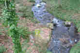
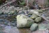
- Ioco Creek originates as sidehill runoff within the boundaries of the Village of Anmore, about 1 km east of Sasamat Lake. Ioco Creek passes under Bedwell Bay Road and flows south through Ioco Townsite (between Second and Third Avenue) to the Port Moody Arm of Burrard Inlet.
- The watershed is bordered to the north and west by the Sasamat Lake watershed, to the east by the North Schoolhouse Creek watershed, and to the south by the Port Moody Arm of Burrard Inlet. The northeast section of this watershed falls within the Village of Anmore boundaries.
- In 1996 4.8% of the watershed was developed and impervious to water and 90% of the riparian forest was intact, with a GVS&DD watershed health rating of 'excellent'.
Watershed Use
- Fish: sampling by the City of Port Moody found Coastal Cutthroat Trout (Onchorhynchus clarki clarki). Prickly sculpin (Cottus asper) have also been observed in this stream.
- Wildlife: various species including black bear, coyote, mule deer, and cougar. Several bird species utilise this area, including great blue herons and bald eagles.
- Vegetation: Western hemlock, Western red cedar, and Douglas fir dominate the stand composition.
- Parks: Ioco Park and the Ioco Lawnbowling and Tennis Club grounds are both near the Ioco Road / First Avenue intersection in the lower section of the watershed.
- Schools Ioco School is at the corner of Ioco Road and First Avenue.
- Residential: predominantly single-family residential houses.
- Industrial: the Imperial Oil Company (Ioco) refinery property occupies most of the western half of this watershed.
- Other: CP Rail has a right-of-way through this watershed.
Concerns
- The culverts at Ioco Road and the CP Rail right of way may be blocking access to the majority of Ioco Creek for anadromous salmonids. The culvert at Bedwell Bay Road does is not a barrier to fish passage.
- Water quality may be slightly affected by future development: impervious (i.e. developed) area is predicted to increase from 4.8% in 1996 to 6.8% in 2036, with a resulting drop in watershed health from 'excellent' to 'good'.
- Several provincially listed plant communities and at least two listed bird species inhabit this watershed.
- Marine sediment at creek mouth severely contaminatied by prior and ongoing industrial activities.
Watershed Projects
- Ongoing water quality and fecal coliform monitoring by Port Moody Ecological Society.