Mackay Creek Watershed
Summary
Characteristics
- Mackay Creek originates at about 2800 ft on the southwest slope of Grouse Mountain
- 29% impervious area in watershed; 54% RFI (GVRD, 1999).
- Status: Endangered – due to impacts of urbanization and the loss of the estuary.
Watershed Use
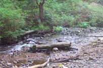
- Fish: coho, chum, pink, cutthroat, steelhead, Dolly Varden and Rainbow trout
- Wildlife corridor; Vegetation: Coastal Western Hemlock Zone
- Grouse Mountain Resort parking lot; Grouse Mountain ski resort
- GVRD water mains; Hydrometric station; Power line
- Residential
· Old gravel pit
- Recreation and Parks
· Commercial industry
Concerns
- Classified as endangered due to effects of urbanization and loss of estuary (DFO, 1998)
- Significant water quality problems (FRAP); Concern over cumulative impacts (FRAP)
- Impervious surfaces (concrete, buildings, etc.) >10% of the watershed (FRAP)
- Development applications propose to divert or modify the floodplain or mouth (DFO, 1998)
- Significant loss of riparian vegetation and rip rapping along stream banks (FRAP)
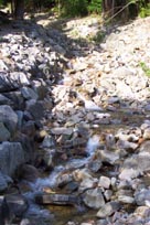
- Bank and slope instability leading to erosion and flooding (Kerr Wood Leidal, 1982)
- Damming in several areas blocks fish passage (Haggard, 1978).
- The ski area is a watershed management concern (Kerr Wood Leidal Associates, 1999)
- The creek runs through 2 municipalities but management not coordinated
Watershed Projects
- Annual Mackay Creek Clean-up; Incubation boxes for coho; Emsley Creek enhancement
- Fish ladder and Wilderness Watch – North Shore Fish and Game Club
- Some storm drain marking
- 91-92 - District 44 school students released coho fry
- 1996 – Habitat restoration following 1995 debris flow