Hett Creek Watershed
Profile
Characteristics
- 14th largest watershed in Port Moody (out of 16) (Robertson 2000).
- Hett Creek discharges into the Port Moody Arm of Burrard Inlet.
- Bordered to the north and west by the Mossom Creek watershed, to the east by the Wilkes Creek watershed, and to the south by the Port Moody Arm of Burrard Inlet. The top of this watershed falls within the Village of Anmore boundaries.
- Average annual watershed precipitation is 1986 mm (GVRD 1999).
- Average annual watershed flow is 1482 mm, with an additional 614 mm from stormwater runoff.
- In 1996 5.6% of the watershed was developed and impervious to water, and 87% of the riparian forest was intact. The 1996 GVS&DD watershed classification was ‘Good’ (GVS&DD 1999).
- In general, the area encompassed by this watershed lies on significant (>35%), south-southwest facing slopes with deep, nutrient-rich soils.
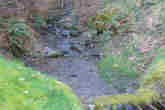
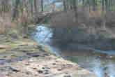
- Hett Creek originates from wetlands near the Port Moody / Anmore boundary and flows south-southwest for 1.75 km to the Port Moody Arm of Burrard Inlet. The upper section is low gradient and runs through poorly defined channels which flood during rainfall events, allowing for groundwater storage. The lower section has a steeper gradient characterized by stable streambeds with boulder and cobble substrate.
History
- Area was logged between 1920-1940 following completion of the “Climax” high-grade locomotive and railway (City of Port Moody website).
- Coastal Cutthroat Troat (Onchorhynchus clarki clarki) and Coho (Onchorhynchus kisutch) inhabited the lower section of Hett Creek until the early 1970’s when major stream alterations rendered the stream uninhabitable (Dunster and AXYS 1999).
- Industrial activities have polluted the marine environment of Port Moody Arm into which Hett Creek flows, leading Environment Canada to identify this area as an “environmental hotspot” in 1992 (Dunster and AXYS 1999). These pollutants include the metals cadmium, chromium, copper, lead, and zinc (originating from metal coating, plastic stabilizers, paint pigments, and, to a lesser extent, pesticides and sewage), as well as organic compounds like oil and grease hydrocarbons and polycylic aromatic hydrocarbons (originating from petroleum facilities). Polychlorinated biphenyls (PCBs, used to produce plastics, inks, paints and pesticides but banned since the mid-1970s) persist in low concentrations throughout Port Moody Arm. In 1987, all of these pollutants occured in the highest concentrations near the Ioco refinery, decreasing in concentration towards Indian Arm and the Port Moody tidal flats (Environment Canada 1989).
- The upper section of the watershed was recommended for designation as an environmentally sensitive area in 2000 (Robertson 2000). Bert Flinn Park was dedicated in 2002 and includes a portion of this area.
Watershed Use
- Residential: predominantly single-family residential houses with some condominiums.
- Parks and recreation: Bert Flinn Park, Hett Creek Ravine, part of the North Shore Escarpment, and Pleasant Hill Park, are all within this watershed.
- CP Rail has a right-of-way near the stream mouth.
- A BC Gas pipeline passes through the wetlands at the upper end of the watershed.
- Fish: coastal cutthroat trout (Onchorhynchus clarki clarki) and prickly sculpin (Cottus asper) probably inhabit this stream, but systematic sampling has not been carried out (Dunster and AXYS 1999, Robertson 2000).
- Wildlife: coyote, black bear, cougar, bobcat, mule deer, Douglas squirrel, red-back vole, deer mouse, Northwestern salamander and Pacific tree frog are among the more prominent terrestrial animals. The Vancouver haplotreme (Haplotrema vancouverensis) is a unique snail that inhabits the wetland area of the upper watershed: it is omnivorous eating both plants and other snails. (Dunster and AXYS 1999).
- Birds: a diverse bird assemblage includes several species of woodpeckers and raptors, American dipper, and, near the mouth of Hett Creek, shorebirds and waterfowl (Dunster and AXYS 1999, Jacques Whitford 2001). Historically, 131 bird species are known to inhabit the Port Moody area (Burke Mountain Naturalists 1994).
- Vegetation: Presently a secondary growth forest ranging in age from 60-80 years. Trees are a mix of western hemlock (Tsuga heterophylla), Douglas fir (Pseudotsuga menziesii), western red cedar (Thuja plicata), red alder (Alnus rubra), broad-leaf maple (Acer macrophyllum) and vine maple (Acer corcinatum). The understory is predominantly salmonberry (Rubus spectabilis), sword fern (Polystichum munitum) and huckleberry (Vaccinium spp.) (Dunster and AXYS 1999). A wetland complex at the headwaters contains basin bog, fen, and flat swamp habitats. These habitats include a diverse assemblage of species occurs, including sedges (Carex spp.), rush (Juncus spp.), king gentian (Gentian sceptrum), reed canarygrass (Phalaris arundinacea), bluejoint reedgrass (Calamagrostis canadensis), and bentgrass (Agrostis capillaris) (ECL Envirowest 1994, 1997). The watershed contains several plant communities are which are of special concern (see below).
Concerns
- Culverts: The first 300 meters of the creek mouth where gradients are low and stream profiles favorable was important fish habitat. This section is now almost completely culverted from Ioco Road until it ‘daylights’ below homes on Alderside Road, just above the stream mouth. An additional culvert is present at Parkside Drive. None of these culverts are passable by salmonids. These along with other major stream alterations (rip-rap armoring, gabion banks, channelisation, storm sewer drainage) have rendered the stream uninhabitable to salmonids.
- Stormwater: The developed area of the watershed is predicted to increase from 5.6% in 1996 to 41.3% in 2036. This is predicted to increase average annual watershed flow from 1482 mm to 1619 mm (GVRD 1999). More importantly, average annual stormwater runoff is predicted to increase from 614 mm to 1066 mm (GVRD 1999). The predicted GVS&DD watershed classification falls from ‘Good’ in 1996 to ‘Fair’ in 2036 as the increase in the relative contribution of stormwater to Hett Creek could increase peak stream flows and introduce water quality issues (GVS&DD 1999). Parkland designation could alter these predictions by allowing less of the watershed to be developed (City of Port Moody Environmental Service personal communication)
- Plant communities of concern: the Western hemlock-flat moss, the Douglas fir / Western hemlock-salal, and the Western red cedar-sword fern commounities are present in this watershed and are provincially blue-listed (of special concern), while the Douglas fir-sword fern and the Western red cedar-salmonberry communities are also present and are provincially red-listed (endangered) (Robertson 2000). The wetland communities at the north end of the watershed are rare in British Columba and especially sensitive to changes in the water table (ECL Envirowest 1994, 1997). These wetland communities are also threatened by the presence of reed canarygrass (Phalaris arundinacea), a non-native invasive species which chokes out native vegetation. The Western pearlflower (Heterocodon rariflorum) also inhabits this area and is a provincially blue-listed (of special concern) species (Dunster and AXYS 1999). The City of Port Moody has pledged protection of north-shore wetlands and their drainages (City of Port Moody 2001).
- Animal species of concern: The Vancouver haplotreme (Haplotrema vancouverensis) is a somewhat rare carnivorous snail that inhabits the wetland area of the upper watershed (Dunster and AXYS 1999).
Key Interest Groups/Government Bodies
- Municipal Government: City of Port Moody, Village of Anmore
- Regional: GVRD, GVS&DD
- Provincial Government: Ministry of Transportation and Highways; Ministry of Environment, Lands and Parks; Burrard Inlet Environmental Action Program
- Federal Government: Fisheries and Oceans Canada, Environment Canada, Transport Canada
- Local NGO’s: Port Moody Ecological Society
- BC Gas
- BC Rail
- Various private landowners and occupants
Watershed Projects
- Ongoing water quality and fecal coliform monitoring by Port Moody Ecological Society.
Bibliography and Available Sources of Information
- Port Moody Public Library. 604 469 4577.
- Port Moody Ecological Society Library. 604 469 9106.
- City of Port Moody Environmental Services. 604 469 4676.
- City of Port Moody website. http://www.cityofportmoody.com/
- Fish Wizard Website. http://pisces.env.gov.bc.ca/
- Burke Mountain Naturalists. 1994. Wildlife Inventory of the Shoreline Park System, Port Moody, BC. Prepared for the City of Port Moody and the Burrard Inlet Environmental Action Program.
- City of Port Moody. 2001. Official Community Plan.
- Dunster and Associates Environmental Consultants Ltd., and AXYS Environmental Consulting Ltd. 1999. City of Port Moody Environmentally Sensitive Areas Management Strategy. Phase 1: An Inventory of Natural Areas. Prepared for the City of Port Moody.
- ECL Environmental Consultants Ltd. 1994. An Environmental Assessment of Neigbourhoods 3 and 4, Port Moody, BC. Unpublished Report Prepared for the City of Port Moody.
- ECL Environmental Consultants Ltd. 1999. Assessment of Wetlands – Neighbourhood 4, Port Moody, BC. Unpublished Report Prepared for the City of Port Moody.
- Environment Canada. 1989. Distribution and Environmental Impact of Selected Benthic Contaminants in Vancouver Harbour, British Columbia: 1985-1987. Pacific and Yukon Region Program Report 89-02.
- Greater Vancouver Regional District. 1999. Watershed flows and stormwater runoff: estimates for 1996 & 2036. http://www.gvrd.bc.ca/services/sewers/drain/Reports/stormwater_rpts_1997-2002/runoff/estimates.pdf
- Greater Vancouver Sewerage and Drainage District. 1999. Assessment of Current and Futrure GVS&DD Area Watershed and Catchment Conditions. http://www.gvrd.bc.ca/services/sewers/drain/Reports/stormwater_rpts_1997-2002/assessment/main_rpt/assessment_watersheds_catchments.pdf
- Robertson Environmental Services Ltd. 2000. City of Port Moody Environmentally Sensitive Areas Management Strategy. Phase 2: Development of Management Recommendations. Prepared for the City of Port Moody.