Lynn Creek Watershed
Summary
Physiography:
- bordered by Seymour River and Mosquito Creek Watersheds in North Vancouver, BC
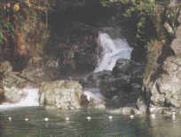
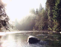
- originates in the protected Lynn Headwaters Regional Park; discharges into Burrard Inlet
- main tributaries: Keith, Hastings, Kennedy, Wickenden, Hanes, and Coliseum Creeks
- 8 % impervious area (8 km2 in total) for entire watershed; 34 % impervious area in Lower Lynn due to heavy residential
- and industrial development (GVRD, 1998?)
History:
- was the water supply for the residents of North Vancouver from 1883 to 1981
- an inactive landfill is located within the watershed boundary; runoff was collected and piped to a treatment plant until 1999; the runoff is now collected by a system of pipes and ditches before it enters the landfill leachate, and is discharged into Lynn Creek
Watershed Use:
- Human: trail system and bridges exist for recreational use and creek is used for swimming; residential; industrial; and train and automobile transportation
- Wildlife: abundant and diverse populations of bird, amphibian and mammal inhabit the headwaters and the less developed portions of the lower watershed (eg. Blackbear, Northern Pygmy Owl, Pileated Woodpecker, Western Red-Backed Salamander)
- Fish: Lynn Creek up to Lynn Falls and the tributaries support coho, pink, chum and chinook salmon; cutthroat, Dolly Varden and steelhead trout
Concerns:
- Classified as endangered in the lower two-thirds of the watershed (DFO, 1998)
- Morphology: complete loss of many tributary streams to urbanization; channelization in flood-hazard areas, along erosion-prone banks and at bridge crossings; bedload deposits; bank erosion in back yards where riparian vegetation has been removed; dredging
- Water Quality: sediments introduced by channel erosion, land slides and human development; chlorine spills from swimming pools; direct discharge of contaminated storm water into Lynn and tributaries (oil, grease, gas, paint, etc); Keith, Hastings and Thames Creeks have serious non-point source pollution; presence of iron oxide
- Hydrology: increase in peak flow frequencies and magnitudes due to increases in effective impervious area.
- Riparian Areas: encroachment by development and loss of riparian vegetation
- Other: complete loss of estuary due to urban/industrial development; culvert crossings reduce fish access to tributary streams