Dunell Creek Watershed
Profile
Characteristics
- Dunell Creek originates on the east slope of Grouse Mountain and flows south through forest until it joins Dyer Creek. Dunell is a small tributary of Hastings Creek which in turn is a tributary of the Lynn Creek system
- Trees in the Lynn Valley area grow tall and slim because they are well sheltered and because they grow so close together they reach for the sun. The Lynn Valley area is also well watered by a network of creeks which carries nutrients from surrounding hills (Steward, 1975)
History
- Hastings Creek and its numerous tributaries made up the prime spawning area for most of the Lynn’s migratory runs of cutthroat, steelhead, coho and chinook
- 1860’s - The first significant non-native settlement began as the Douglas-fir and Western white pine were cut for spars or sailing ship masts and exported to Britain for Royal Navy ships. Lynn Valley became known as spar forest as it provided spars 70 feet long and 13 feet in diameter
- 1875 – Logging for red cedar bolts became the main activity
- 1895 - World’s largest fir tree felled in Lynn Valley settlement area: Over 2000 years old; 417 feet high; 77 feet in circumference at the butt; 16 inch thick bark.
- Early 1900’s – Accidental introduction of white pine blister rust (Cronartium ribicola) results in the loss of most of the Western white pine on the North Shore
- Lynn Valley Population: 1909 = 200; 1919 = 1400; 1971 = 25,000
- 1926 – Logging in Lynn Valley finishes
- Late 1940’s – Balsam woody aphid (Chermes piceae) is introduced impacting the Amabilis fir
Watershed Use
- Fish: Cutthroat Trout
- Wildlife: Various species including raccoons, mink, river otters, black bears, Belted Kingfishers, Dippers, Great Blue Herons, Common Mergansers, Harlequin Ducks, and Swallows (Tera Environmental Consultants Ltd.)
- Vegetation: Coastal Western Hemlock, dry subzone. Remaining native trees in watershed include western hemlock, douglas-fir, western red cedar, big leaf maple, and red alder up to about 120 years old
- Trails: Used by hikers and mountain bikers
Concerns
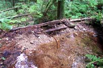
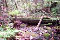
- Large amounts of organic debris including trees that appear to have been cut and left in the creek are obscuring the creek and creating a barrier to fish. Continues for approximately 15 m
- Use of the area by mountain bikers is causing bank erosion and loss of riparian vegetation
- Unauthorized construction has occurred in the creek
Key Interest Groups/Government Bodies
- Municipal Gov’t: District of North Vancouver (DNV); District Parks Department; Lynn Canyon Ecology Centre
- Regional Gov’t: GVRD (regional parks, sewers and air quality); GVWD
- Provincial Gov’t: Ministry of Transportation and Highways; Ministry of Environment, Lands and Parks
- Federal Gov’t: Department of Fisheries and Oceans; Environment Canada; Transport Canada
- Local NGO’s: North Shore Streamkeepers; North Shore Fish and Game Club; Pacific Streamkeepers Federation; Lynn Valley Community Association
- BC Hydro
- School District 44
- North (Shore/Vancouver) Historical Society
- Mountain bikers
Watershed Projects
Recommendations and Suggested Actions Bibliography and Available Sources of Information
Note: Very little information exists on Dunell Creek. Most of the following references provide only indirect information on Dunell.
BC Ministry of Environment, Lands and Parks. TRIM/UTM Maps.
Bouton, Cherry. (2000). North Shore History. www.cherrybouton.com/nshistory.html
Clark, B. (1985). Hastings Creek Habitat Evaluation. MoE: Fish and Wildlife Branch. Surrey, B.C.
District of North Vancouver. (2001). GIS Database.
District of North Vancouver Website. (2001). Hastings Creek Salmon Restoration Update. www.district.north-van.bc.ca/admin2/depart/enviro/hastings%5Fcreek% 5Fupdate.html
District of North Vancouver. Lynn Valley Official Community Plan.
Draycot, Walter. (1912). "Lynn Valley: From the Wilds of Nature to Civilization". North Vancouver.
Draycot, Walter. (February 2000). Early Days in Lynn Valley. North Vancouver, BC: Contact Printing and Mailing Ltd.
Gabby. "Logging History of the North Shore". (1994). North Vancouver: Lynn Canyon Ecology Centre Library.
North Shore Streamkeepers. (Spring 2001). Preliminary Watershed Assessments of 12 North Shore Creeks. Unpublished.
The Lynn-Seymour Rivers and the Hastings Stream: Geologic History of Their Origin.
Steward, Barry. "Lynn Valley’s Creeks and Fish Habitats". (1975). North Vancouver: Lynn Canyon Ecology Centre. (North Shore Archives).
Tera Environmental Consultants Ltd. Seymour-Lynn Vegetation and Wildlife Species List.